Contributor Nathan Cuvelier and his father ride some some epic Appalachian and Blue Ridge backroads on their Virginia and West Virginia motorcycle tour, including Back of the Dragon, Claw of the Dragon, and many others. In West Virginia, they visit Wytheville, Pocahontas County, and Elkins-Randolph County. This story was originally published in the August 2022 issue of Rider.
The best $4 I ever spent was at The Clean Cow in Marlinton, West Virginia, in the heart of Pocahontas County. It bought me a second-hand fleece, a desperately needed layer under my Joe Rocket mesh jacket to keep me warm while riding under overcast skies in low 60-degree temps through light mist. Although the weather didn’t cooperate the whole trip, Dad and I still managed a great week on some epic backroads in our Virginia and West Virginia motorcycle tour.
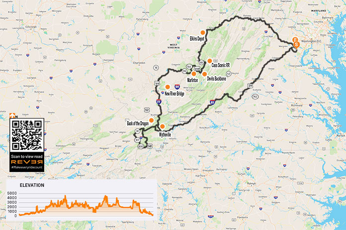
Scan QR code above or click here to view the route on REVER
Weather the first day was fantastic. Under partly cloudy skies, Dad and I took our time heading south through central Virginia via U.S. Route 29, a divided four-lane highway. Dad was on his 2010 Triumph Tiger, and I was on my 2011 Triumph Sprint GT. About 50 miles past Charlottesville, we took U.S. Route 60 to cross over the Blue Ridge Parkway – the ascent and descent giving us our first taste of the twists and turns where motorcycles excel. At Buena Vista, we joined U.S. Route 501 South and made our first rest stop at Natural Bridge State Park. The 215-foot natural limestone bridge was once owned by Thomas Jefferson and allegedly surveyed by a young George Washington.
Slaying Dragons
We avoided the super slab for as long as possible, but dark clouds rolling in from the south forced us to hop on Interstate 81 after Natural Bridge and cope with buffeting semis. At Wytheville, we took the back way to Bland via U.S. Route 52. Late in the day, with rain clouds above, U.S. 52’s sparse traffic and gentle ascent along the ridge of Big Walker Mountain made us feel truly isolated on a road carved through a sea of forest. Eventually we arrived at Big Walker Motel in Bland, which served as our home base for two days of riding Claw of the Dragon.
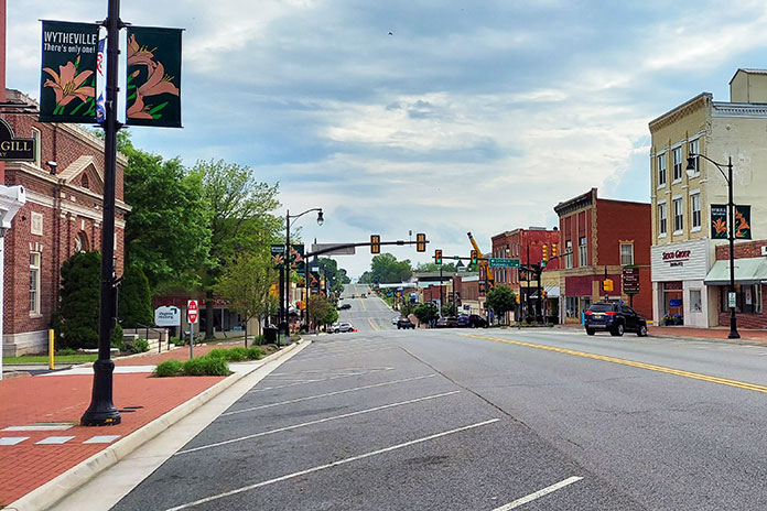
Learn more about Wytheville and Claw of the Dragon (including maps) here.
The five talons of the claw grasping the “C” on the Claw of the Dragon brochure represent the five loops that total more than 350 miles of rider Valhalla. The brochure might as well be a theme park map for motorcyclists, as completing all five loops and soaking in all the culture and scenery that make up the park would be at least a week of heavenly riding.
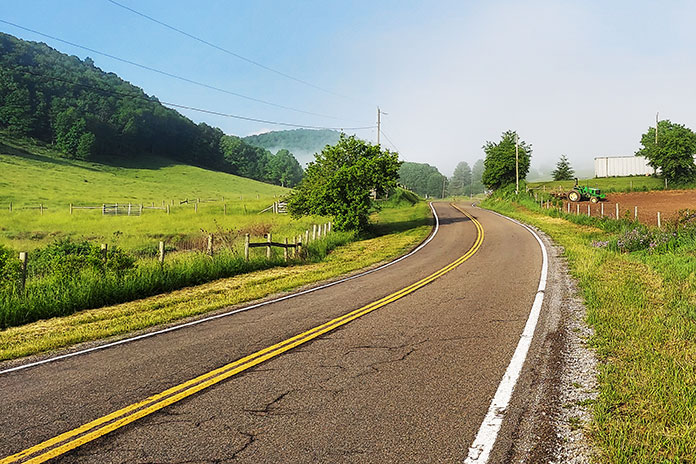
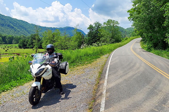
For our second day, Dad and I chose the 138-mile Marion Loop, which includes the well-known Back of the Dragon. From Bland, we headed west on U.S. 52 to State Route 42 (West Bluegrass Trail) and followed it to the intersection with State Route 16. Our early departure rewarded us with views of the morning fog blanketing portions of the valley. The easy-going, well-maintained Route 42 weaved through grazing country, where we our riding served as entertainment for Angus, Jersey, and Holstein cows. While I was tempted to dial up more throttle and gobble up the miles, I kept to the speed limit so Dad could enjoy the rolling hills and full-on spring beauty throughout the farm country. Visiting from the desert, all the greenery was a treat for him.
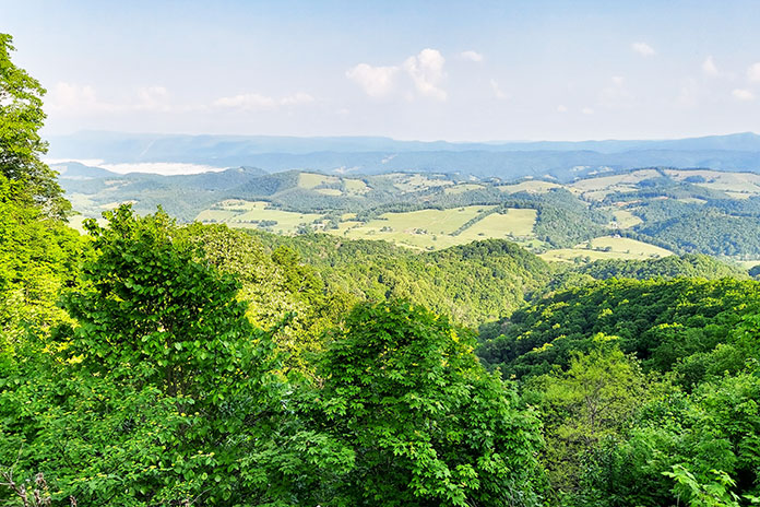
At Route 16, we headed south for a clockwise tack of the Marion Loop, and it was at that point that the Claw really made its grasp. We were at the midpoint of the Back of the Dragon, and in no time we were leaning into ascending curves, downshifting to navigate blind 15-mph switchbacks, and catching brief glimpses of the valley below before navigating yet another left-right, one-two punch. At Walker Mountain Overlook, we stopped to catch our breath to get a clear view of the valley below.
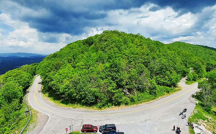
Get maps and other information on Back of the Dragon and other Appalachian backroads here.
The loop continued to Volney, where we took U.S. Route 58 (Highlands Parkway) west past Grayson Highlands State Park and hillsides of young fir trees that will one day be in homes adorned with Christmas decorations and presents underneath. The road shares the valley with Helton Creek, which was occasionally visible through the lush vegetation. If you’re not careful, you’ll miss the sign for State Route 600 (Whitetop Mountain Road), which skirts Mount Rogers, Virginia’s highest peak at 5,729 feet, and then turns into State Route 762 (Whitetop Road) just past Skulls Gap to Chilhowie, after which it changes again to State Route 107.
Dad and I put the kickstands down for burgers at Coach’s Diner in Saltville, a town named after the essential mineral that’s been mined there since the 1780s. Thousands of years ago, the salt attracted mastodons, which visitors can see a full-size cast of at the Museum of the Middle Appalachians, along with other exhibits that represent the story of the area.
We left town going north on State Route 91, which becomes State Route 601 and flanks the Holston River in a bucolic valley setting. Eventually Route 601 intersects with Route 16, where we got another workout on Back of the Dragon – one last stretch of extreme twisties in dense foliage to complete the Marion Loop.
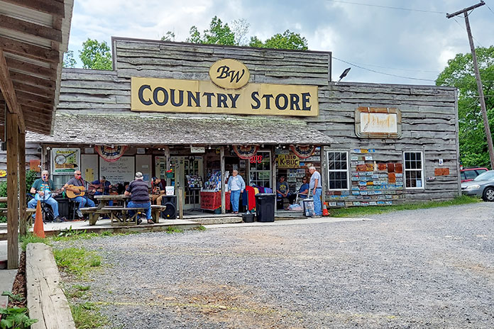
While riding back to the motel along parts of the Bastion and Bland loop of the Claw of the Dragon, Dad and I detoured for a stop at Big Walker Lookout. After another exhilarating ascent packed with more twists than a murder mystery, we pulled into the parking lot in front of the Big Walker Country Store, where I bought a ticket to climb the adjacent observation tower, atop of which five states can be seen on clear days. As an affiliated venue of the Virginia Heritage Music Trail, the Country Store headlined the Central Pickers, a local band that belted out classic rock and hill-country ballads while we relaxed after a full day of riding.
Late afternoon clouds foretold a shower headed our way, so we mounted up for a dash back to Bland. Unfortunately, we were caught in the deluge a few miles from the motel. As road conditions go, the Bland Loop is in excellent shape, with only minor patches and cracks in the more mountainous areas. As we learned, it pays to ride cautiously during and after rainstorms because debris from gulches sometimes spills onto the road, especially in tight, blind corners.
See all of Rider‘s Virginia touring stories here.
A Gorgeous Bridge
Rain in the forecast for the next day cut our Claw of the Dragon stay a day short. To beat the rain, we checked out early and rode Interstate 77 north to Beckley, West Virginia, jogged east on Interstate 64, and then took U.S. Route 19 north to Fayetteville. We waited for check-in time in the warm confines of Tudor’s Biscuit World. Four hours of breakfast and coffee gave us plenty of time to hash out routes and stops the next day and read up on the New River Gorge Bridge in Victor, West Virginia. While it’s called the New River, it’s anything but. Some estimate the river is 320-330 million years old based on some of the limestone sections that hold ancient marine fossils.
Although the weather was chillier than we expected for late May, no rain was forecast the next day. With our bags mounted and secured, we eased out our clutches and rode the short distance to the Canyon Rim Visitor Center just across the New River Gorge Bridge and off Route 19. We wanted to cross the New River the way folks did prior to 1977. Although we didn’t see any pedestrians that morning, visitors can walk under the bridge along the steel structure. At over 800 feet high, the walk was a bit more than I could handle.
See all of Rider‘s West Virginia touring stories here.
From the visitor center, we rode south on the one-way Fayette Station Road and started a serious 15-mph descent down to the New River. Rain from the previous day had deposited debris and loose gravel on the road, so we used extra caution. At the bottom, we parked the bikes on Tunney Hunsaker Bridge, built circa 1889, snapped pictures, and marveled at the size and height of the newer, larger bridge in the background.
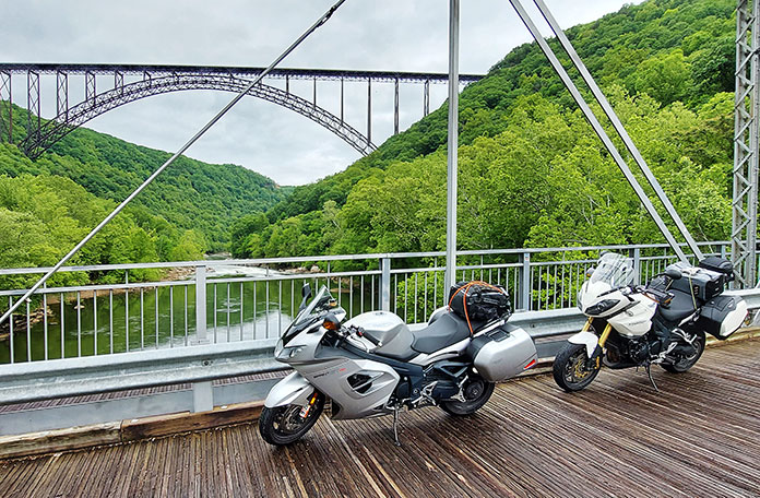
While we didn’t see any rafters, the New River area offers arguably the best whitewater rafting experience in the East. Zip lining, rock climbing, hiking, mountain biking, and other outdoor adventures are also available. You can even ditch the motorcycles for a day and rent ATVs and rip through hundreds of miles of trails.
After we ascended back up the gorge, now south of the river, we crossed the bridge again heading north on Route 19 for another 15 miles before turning east on State Route 39. We stopped in Richwood, a former lumber and mining town, its past booms evident from the elegant brick buildings that were once banks. We grabbed a bite at the Oakford Diner, and when Dad asked a patron what industry currently supports the town, the answer was “restaurants.”
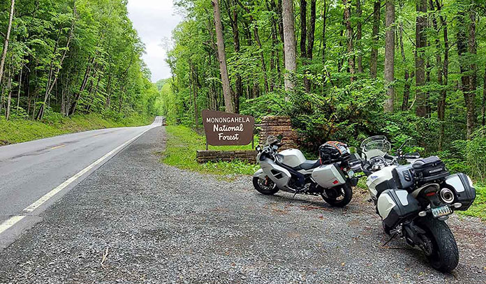
Just outside of Richwood, we entered the Monongahela Natural Forest, where Route 39 becomes Highland Scenic Highway. The “Highland” name is justified, as the elevation ranges from around 2,300 feet in Richwood to more than 4,500 feet along the Route 150 parkway section. The roads are well maintained and mostly straight compared with our previous days’ rides, and I noticed that most of the semis were hauling lumber.
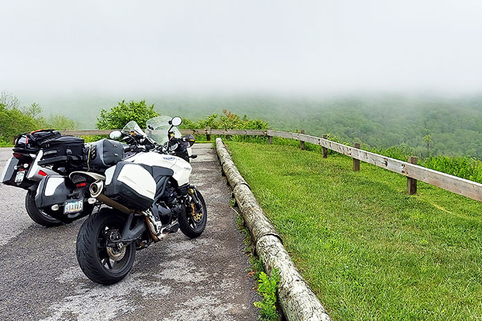
Soon after crossing into Pocahontas County, we turned north on Route 150 and started our ascent into low hanging clouds. I adhered to the 45-mph speed limit because in some places visibility was less than 30 feet. This 23-mile section is not maintained in the winter, and the Forest Service discourages travel between November and April. Dad and I passed two of the four scenic overlooks before pausing at the Little Laurel Scenic Overlook, where we could just catch a glimpse of the valley under the cloud cover. I could only imagine the serenity of early summer mornings from that spot.
Get travel, lodging, dining, and other information about Pocahontas County, West Virginia, here.
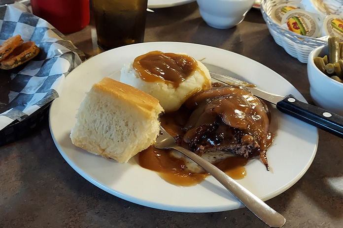
Route 150 terminates at U.S. Route 219, where we headed south to Marlinton Motor Inn, near the town of Marlinton. After checking in, we rode over to Greenbrier Grille and Lodge, located on the Greenbrier River, where Dad and I shared an appetizer of fried pickles and dined on hamburger steak.
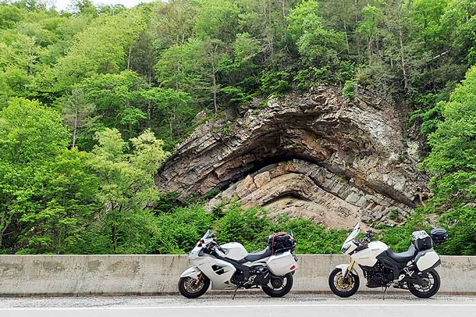
We were back at the Greenbrier the next morning for an early-riser breakfast. Afterward, we walked over to The Clean Cow, a combination laundromat and thrift store, for my fleece jacket purchase. With my new layer of warmth, we motored east on Route 39. Just past Huntersville, we almost cruised by Devil’s Backbone. The visible folds of rock layers framed by the surrounding trees are a testament to the power of nature and worth a couple of pictures. A nearby sign revealed that the Tuscarora Sandstone layer present in the fold is proof that the area was under the ocean at one time.
Working on the Railroad
After doubling back on Route 39, we turned north on State Route 28 and cruised until we saw signs for Cass Scenic Railroad State Park. We turned west on State Route 66 and a few miles later arrived at Cass, a town created in 1901 by the West Virginia Pulp and Paper Company. We parked the bikes next to the Cass Company Store building, bought some souvenirs, and made our way to the museum.
After Jerry, a volunteer at the museum, saw Dad drop a five spot in the till, we were given special treatment. Jerry went out of his way to tell us about the history of Cass and the artifacts displayed in the museum. He even opened the Cass Historic Theater and fired up the projector for our own personal viewing of a short film about the history of Cass. One artifact made my jaw drop: a purchase request by the Wright brothers for 500 board-feet of red spruce.
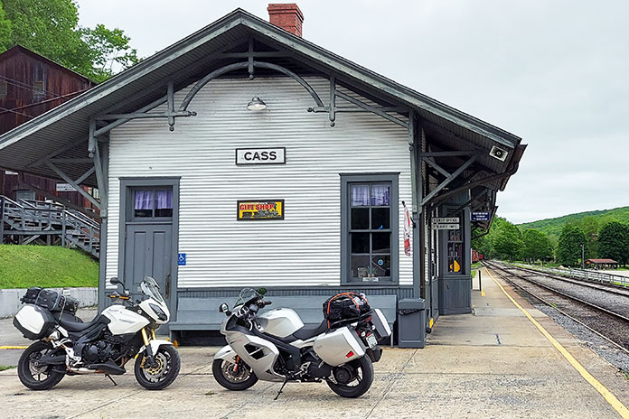
While no trains ran the day of our stop, visitors to Cass can ride original Shay steam-powered locomotives once used to haul lumber from remote spots in the mountains to Bald Knob, West Virginia’s third highest peak. The company housing built from the surrounding forest can be rented out and serves as a good home base for groups planning loop rides through the Monongahela and Washington national forests.
From Cass, we made our way on Route 66 toward Route 219. While I thought I might be able to shed the fleece, Dad warned against it. Sure enough, after easing out of Cass, we ascended more than 1,000 feet near the Snowshoe Mountain ski resort before dropping back down to the terminus of Route 66 at Route 219, also called the Seneca Trail.
Technical twists and turns in our rearview mirror, the Seneca Trail presented a more laidback cruising speed as we crossed into Randolph County. Dad and I even coordinated through our Bluetooth comms when to ease to the side of the road and let traffic pass from behind. We didn’t want to miss surrounding scenery as the trail winds north alongside the Tygart Valley River, water from which finds its way into the Monongahela, the Ohio, and eventually the Mississippi River. Quite the journey.
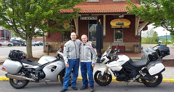
We checked into our hotel in Elkins, but rather than eat at one of the restaurants in the revitalized area surrounding the Elkins Depot of the Durban & Greenbrier Valley Railroad, we chose Scottie’s of Elkins for dinner. Only a short walk from the hotel, I could tell the food would be good because the place was packed with locals. Dad and I both had the lasagna special and were fully satisfied.
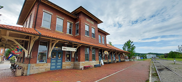
The Elkins Depot is a must stop for anyone interested in what West Virginia has to offer. Brochures, maps, and magazines are all available. I even spotted the latest edition of Rider magazine! During the summer months, the New Tygart Flyer train departs from the depot and offers riders a round trip to the High Falls of the Cheat River.
The Home Run
Thankfully, our last day of travel served up bright blue skies. From Elkins, we continued north on U.S. Route 48/219 past Parsons and on to Thomas, West Virginia, for one last stop at a landmark called Fairfax Stone State Park. To establish the northernmost boundary of Lord Fairfax’s estate, George Washington and a fellow surveyor placed a marker in 1748. It’s at that spot where the headwaters of the North Branch of the Potomac River begin. As with much of the ride, the mountain roads offer plenty of distant ridge lines to ponder as well as the sites we’d seen in the last few days.
In the homestretch on our 1,000-mile journey, I reflected on the resiliency and bounty of nature. The woodlands, rivers, soil, and mineral deposits in the Appalachians of Virginia and West Virginia fueled the growth of the region and our nation. Over the years, there have been booms and busts, good times and bad. Dad and I rode through revitalized towns, thriving communities, and lush forests, but we also saw abandoned houses and dilapidated farm structures returning to the earth from which they came.
While industries like logging and mining have constracted, the roads and rails intended to bring those natural resources to market still exist. In a twist of fate, they now bring resources back in rather than pulling them out. Rich reserves of rugged beauty, undulating curves, and small-town charm attract visitors like Dad and me, eager to experience and explore.
We’ll be back, and next time I’ll bring a sweater.

